
Where is the OpenStreetMap offline innovation?
Two days ago Steve Coast posted a great project on Kickstarter. He’s printing high quality maps of various cities made from GPS traces. I backed the project as soon as I saw it, and look forward to having a framed GPS map of London on my wall in the near future (pic below). The fact that two days after posting the project he’s already 800% oversubscribed shows there’s a lot of demand for this.
I’ve thought about a similar idea for some time - why has no one yet combined OpenStreetMap data and all the artistic freedom it allows (see Stamen’s watercolor maps as one example of many) and high quality printing? Basically I want a Moo.com for maps. I want a great user interface that lets me center the map to wherever I like, choose from some great looking designs, and then have a high quality, poster-size map printed and physically delivered to me. Bonus points if I can get it framed, can upload my own dataset to have highlighted on the map, etc.
I would love to have a big map of London in the Nestoria office with our office at the exact center of the map. Likewise I can think of all sorts of promotional materials that could be made. Imagine if the day you closed on the purchase of your new home the estate agent gave you, along with the keys, a high quality map of your city or neighborhood with your house centered.
Too much of the current discussion of maps focuses on maps as tools. I think there’s a huge untapped market for maps as art/cultural/promotional items. Yes, I use digital tools, but I live my life in the offline world. The availability of OpenStreetMap should be unleashing a flood of creativity for physical maps.
Besides this effort from Steve, I’m also aware of Splashmaps, who gave a great talk at #geomob a few months back, but that’s it.
I’d love to connect with, partner with, and possibly invest in anyone who working in this space.
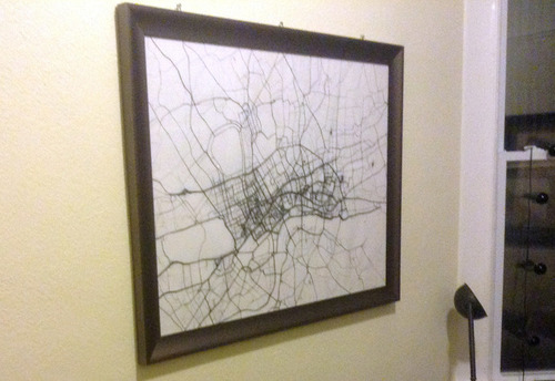
Photo from Steve’s Kickstarter page.